- Overview
- Features
- Australian Data
- New Zealand Data
- Installation
| Version Number | Length of Road Covered |
|---|---|
| Version 23/12 TomTom | 1,459,541 km |
| Version 22/11 TomTom | 1,329,150 km |
| Version 21/10 Whereis® Maps | 1,322,187 km |
| Version 20/9 Whereis® Maps | 1,318,325 km |
| Version 19/8 Whereis® Maps | 1,303,570 km |
| Version 18/7 Whereis® Maps | 1,290,817 km |
| Version 17/6 Whereis® Maps | 1,285,021 km |
ADVANCED GUIDANCE
Guidance on the best lane to be in to prepare yourself for an upcoming turn, exit or to continue on your current course.
EXTENSIVE POINTS OF INTEREST
TomTom leverages the content collected by the Yellow Pages® and White Pages® directories as well as more than 160 other sources of data.
ROAD NETWORK
TomTom Map data covers 99.1% of the street network in Australia and New Zealand - that’s pretty much everywhere!
VICTORIA MAP DATA FEATURES
- Princes Highway upgrade - Traralgon East to Flynn.
- Narre Warren - Cranbourne Road upgrade between Pound Road
- and Thompson Road.
- Geelong Ring Road Baanip Boulevard - Surfcoast Highway connection.
- Koo Wee Rup bypass.
- Hoppers Lane - Princes Highway intersection realignment.
- Princes Highway upgrade - Nambrok.
- CLONE - Stud Road duplication.
- M80 Ring Road upgrade - Edgars Road to Plenty Road.
TASMANIA MAP MAJOR NEW CHANGES
- East Derwent Highway - Goodwood Slip Road.
- Tasman Highway access improvements - East Derwent Highway.
- Montagu Bay interchange.
SOUTH AUSTRALIA MAJOR NEW CHANGES
- Thiele Highway, Daveyston Road and Hanson Street staggered
- T-Intersection upgrade
- Penola Southern bypass
NEW SOUTH WALES MAJOR NEW CHANGES
- The Northern Road upgrade - Cranebrook.
- Great Western Highway upgrade - Bullaburra West.
- Glenfield Road upgrade.
- West Gosford - Racecourse Road improvements.
- Carlingford - Pennant Hills Road and Marsden Road intersection upgrade.
- Terrigal Drive traffic and safety improvements at Jessie Hurley Drive and Portsmouth Road.
- Princes Highway upgrade - Gerringong.
- Camden Valley Way upgrade - Oran Park Drive (Cobbitty Road) to Bringelly Road (Cowpasture Road).
- Newcastle inner city bypass - Sandgate and Shortland.
- Great Western Highway upgrade - Woodford to Hazelbrook
- Princes Hwy improvements - South Nowra between Kinghorne Street and Forest Road.
QUEENSLAND MAJOR NEW CHANGES
- North Lakes Bridge.
- Mooloolaba Road safety improvement project.
- Gateway Motorway additional lane project.
- Brown Street Bridge.
- North Lakes Bridge.
- Tamborine-Oxenford Road: John Muntz Bridge.
- Bruce Highway upgrade from Cooroy to Curra (Section A - Cooroy southern interchange to Sankeys Road).
- Mains Road & Kessels Road upgrade.
NORTHERN TERRITORY MAJOR NEW CHANGES
- Temple Terrace and Stuart Hwy intersection upgrade.
- Tiger Brennan Drive duplication - Dinah Beach Road to Woolner Road
WESTERN AUSTRALIA MAJOR NEW CHANGES
- Bussell Highway upgrade - Vasse to Margaret River.
- Tonkin Highway - Horrie Miller Drive & Kewdale Road interchange.
- Tonkin Highway & Leach Highway interchange.
- Kwinana Freeway southbound widening - Roe Highway to Armadale Road.
- Lloyd Street rail corridor grade separation.
- Gateway WA - Leach Highway & Abernethy Road intersection.
- Gateway WA - Kewdale Industrial Precinct improvements.
- Gateway WA - Abernethy Road on-ramp to Tonkin Highway.
- Elizabeth Quay project.
SOUTH ISLAND MAJOR NEW CHANGES
- Springlands intersection improvements.
- SH1 Dashwood rail overbridge replacement.
- Caversham Highway improvements - Stage 2.
NORTH ISLAND MAJOR NEW CHANGES
SH1 Whangarei Upgrade – SH1/SH14 Intersection.
- SSH1 Wainui interchange.
- SH2/SH25 intersection improvement.
- Memorial Park – Buckle Street underpass.
- SH1 Whangarei upgrade – SH1/SH14 intersection.
- SH1 Whangarei upgrade – Selwyn Avenue to Wilson Avenue.
- SH33 Sun Valley/Pareteiro Curves realignment.
- SH16 North-Western Motorway improvements – Lincoln Road interchange upgrade.
- Hamilton Ring Road: Wairere Drive 4-Laning (Pukete Road to Resolution Drive).
- SH1 Wainui interchange.
- Tauranga Eastern Link.
HOW DO I UPDATE MY MAPS?
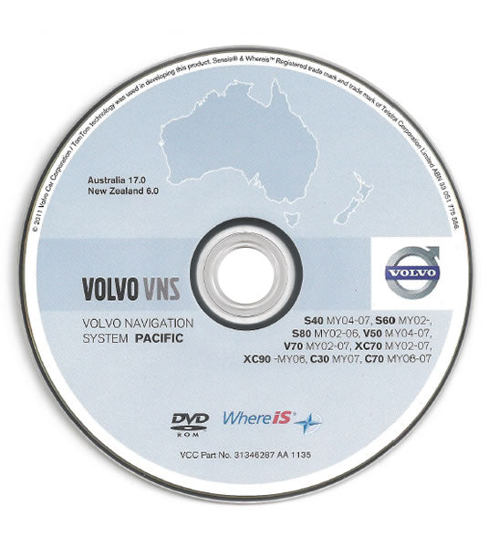
For those of us that have an in-built dashboard satellite navigation system in our vehicle, the maps do not automatically update themselves but thankfully it’s easy to do.
All you need to do is insert the DVD or SD card into your vehicle’s electronic navigation unit then follow the instructions. You’ll find it can take up to five minutes, so be patient and make sure to keep your vehicle on for the entire upload process.
Once the data upload is complete, a message will appear on the dashboard display. Simply follow the system prompts from there to complete the process. Easy!
For any questions, please contact your local car dealer or contact TomTom on 1800 819 471.


